top of page

ForestEyes Project: Citizens can help to stop the Amazon Deforestation!

Scientific Team
- Coordinators: Dr. Álvaro L. Fazenda (UNIFESP/BRAZIL) and Dr. Fabio A. Faria (IST/PORTUGAL);
- Collaborators: Dr. Fabio Cappabianco (UNIFESP/BRAZIL), Dr. Luis Pereira (UNIFESP/BRAZIL)Dra. Fernanda B. Dallaqua and Bsc. Amanda de Oliveira (FATEC/BRAZIL);
-
Currently Students: Hugo Resende (PhD. at UNIFESP), Eduardo Bouhid (Undergraduate at UNIFESP)
-
Technical Training: Vinicius Queiroz (Msc. at INPE/BRAZIL) and Juan (PERU);

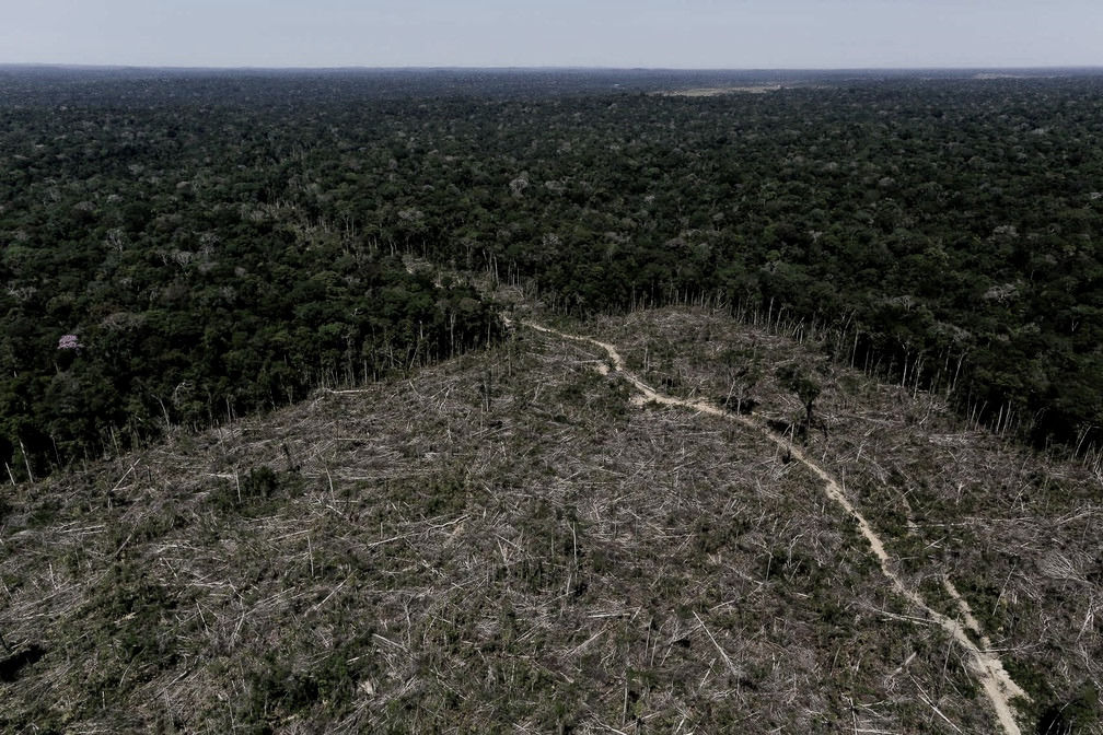
Rainforests play an important role in the global ecosystem. However, significant regions of them are facing deforestation and degradation due to several reasons. Diverse government and private initiatives were created to monitor and alert for deforestation increases from remote sensing images, using different ways to deal with the notable amount of generated data. Citizen Science projects can also be used to reach the same goal. Citizen Science consists of scientific research involving nonprofessional volunteers for analyzing, collecting data, and using their computational resources to outcome advancements in science and to increase the public's understanding of problems in specific knowledge areas such as astronomy, chemistry, mathematics, and physics. In this sense, this work presents a Citizen Science project called ForestEyes, which uses volunteer's answers through the analysis and classification of remote sensing images to monitor deforestation regions in rainforests. To evaluate the quality of those answers, different campaigns/workflows were launched using remote sensing images from Brazilian Legal Amazon and their results were compared to an official groundtruth from the Amazon Deforestation Monitoring Project PRODES. In this work, the first two workflows that enclose the State of Rondônia (Amazon Forest) in the years 2013 and 2016 received more than 35,000 answers from 383 volunteers in the 2,050 created tasks in only two and a half weeks after their launch. For the other four workflows, even enclosing the same area (Rondônia) and different setups (e.g., image segmentation method, image resolution, and detection target), they received 51,035 volunteers' answers gathered from 281 volunteers in 3,358 tasks. In the performed experiments, it was possible to observe that the volunteers achieved satisfactory overall accuracy in the classification of forestation and non-forestation areas using the ForestEyes project. Furthermore, considering an efficient segmentation and a better image resolution, they can achieve outstanding effectiveness results in the classification task of recent deforestation images. Therefore, these results show that Citizen Science might be a powerful tool in monitoring deforestation regions in rainforests as well as in obtaining high-quality labeled data.
Abstract

Published Papers
-
RESENDE, H. ; FAZENDA, A.L. ; de OLIVEIRA, AAS. ; CAPPABIANCO, F.A.M. ; FARIA, F.A. Citizen Science in Action: Building Trust in Deforestation Data Through Continuous Reliability Enhancements. IEEE Journal of Selected Topics in Applied Earth Observations and Remote Sensing, 2026. [link]
-
RESENDE, H. ; FAZENDA, A.L.; CAPPABIANCO, F.A.M. ; FARIA, F.A. Increasing the reliability of citizen science campaign data for deforestation detection in tropical forests. Future Generation Computer Systems 175, 108081, 2026. [link]
-
RESENDE, H. ; Faria, F.A.; NETO, E.B. ; Borlido, I.; Sundermann, V. ; Guimarães, S.J.F. Do Superpixel Segmentation Methods Influence Deforestation Image Classification? The Iberoamerican Congress on Pattern Recognition (CIARP 2025). [link]
-
RESENDE, H. ; Faria, F.A. ; Fazenda, A.L. ; Performance Assessment of Optical and SAR Imagery for Superpixel-Based Deforestation Mapping in the ForestEyes Project. Conference on Graphics, Patterns and Images (SIBGRAPI), 385-390, 2025. [link]
-
RESENDE, H. ; BORLIDO, I. ; BOUHID NETO, E. ; SUNDERMANN, V. ; GUIMARÃES, S. J. F. ; FARIA, F.A.; FAZENDA, A. L.. Exploring Superpixel Segmentation Methods in the Context of Citizen Science and Deforestation Detection. IEEE International Geoscience and Remote Sensing Symposium (IGARSS), 2025. [link]
-
RESENDE, H; FAZENDA, A. L.; FARIA, F.A. . Rotulagem Massiva de Imagens por Ciência Cidadã para Detecção de Desmatamento. XVI Workshop de Computação Aplicada à Gestão do Meio Ambiente e Recursos Naturais (WCAMA), 2025. [link]
-
QUEIROZ, V. D. B.; RESENDE, H.; FARIA, F. A.; CAPPABIANCO, F.; FAZENDA, A. L.. Assessing the potential of SAR images in the ForestEyes project's citizen science campaings. SIMPóSIO BRASILEIRO DE SENSORIAMENTO REMOTO (SBSR), 2025. [link]
-
BORLIDO, I. ; BOUHID NETO, E. ; SUNDERMANN, V. ; RESENDE, H. ; FAZENDA, A. L.; FARIA, F.A. ; GUIMARÃES, S. J. F. . How to Identify Good Superpixels for Deforestation Detection on Tropical Rainforests. IEEE Geoscience and Remote Sensing Letters (GRSL), 2024. [link]
-
RESENDE, H. ; BOUHID NETO, E. ; CAPPABIANCO, F. A. M. ; FAZENDA, A. L.; FARIA, F.A. . Sampling Strategies based on Wisdom of Crowds for Amazon Deforestation Detection. 37st Conference on Graphics, Patterns and Images (SIBGRAPI), 2024. [link]
-
BOUHID NETO, E. ; FARIA, F.A.. ; de OLIVEIRA, A. A. S.; FAZENDA, A. L. . A Satellite Band Selection Framework for Amazon Forest Deforestation Detection Task. In: The Genetic and Evolutionary Computation Conference (GECCO), 2024. [link]
-
FAZENDA, A. L. ; FARIA, F.A. . ForestEyes: Citizen Scientists and Machine Learning Assisting Rainforest Conservation. COMMUNICATIONS OF THE ACM (CACM), 2024.[link]
-
BOUHID NETO, E. ; PEDRO, P. R. C. ; FAZENDA, A. L. ; FARIA, F.A. . Um arcabouço de Seleção de Bandas Landsat-8 baseado em UMDA para Detecção de Desmatamento. In: Workshop of Undergraduate Works (WUW-SIBGRAPI), 2023. [link] best paper
-
PIMENTA, G. A.; DALLAQUA, F. B.; FAZENDA, A. L.; FARIA, F A. Neuroevolution-based Classifiers for Deforestation Detection in Tropical Forests. 35st Conference on Graphics, Patterns and Images (SIBGRAPI), 2022. [link]
-
DALLAQUA, F. B.; FAZENDA, A. L.; FARIA, F A. Cidadãos Comuns Ajudando no Combate ao Desmatamento das Florestas Tropicais. Computação Brasil (CP), 2021. [link]
-
DALLAQUA, F. B.; FAZENDA, A. L.; FARIA, F A. ForestEyes Project: Conception, Enhancements, and Challenges. Elsevier Future Generation Computer System (FGCS), 2021. [link]
-
DALLAQUA, F. B.; Projeto ForestEyes – Ciência Cidadã e Aprendizado de Máquina na Detecção de Áreas Desmatadas em Florestas Tropicais. Thesis, 2020. [link]
-
DALLAQUA, F. B.; FARIA, F A.; FAZENDA, A. L. Building Data Sets for Rainforest Deforestation Detection Through a Citizen Science Project. IEEE Geoscience and Remote Sensing Letters (GRSL), 2020. [link]
- DALLAQUA, F. B.; FARIA, F A.; FAZENDA, A. L. Projeto ForestEyes: Uma proposta para aliar Ciência Cidadã e Aprendizado de Máquina para monitoramento de desmatamento. In: Brazilian Symposium on Geoinformatics, 2020, São José dos Campos. Brazilian Symposium on Geoinformatics (GeoINFO), 2020. [link]
- DALLAQUA, F. B. ; FAZENDA, A. L. ; FARIA, FABIO A. . Aprendizado Ativo com dados de Ciência Cidadã para o monitoramento de florestas tropicais. In: Escola Regional de Aprendizagem de Máquina e Inteligência Artificial de São Paulo (ERAMIA-SP), 2020. [link] best paper
-
DALLAQUA, F. B.; FAZENDA, A. L. ; FARIA, F A. ForestEyes Project: Can Citizen Scientists Help Rainforests? 15th International Conference on eScience (eScience), 18-27, 2019. [link]
-
DALLAQUA, F. B.; FARIA, F A.; FAZENDA, A. L. Active Learning Approaches for Deforested Area Classification. 31st Conference on Graphics, Patterns and Images (SIBGRAPI), 48, 2018. [link]
Datasets
-
BOUHID NETO, E. ; FARIA, F.A.. ; de OLIVEIRA, A. A. S.; FAZENDA, A. L. . A Satellite Band Selection Framework for Amazon Forest Deforestation Detection Task. In: The Genetic and Evolutionary Computation Conference (GECCO), 2024. [link]
-
Building Data Sets for Rainforest Deforestation Detection Through a Citizen Science Project. IEEE Geoscience and Remote Sensing Letters (IEEE GRSL), 2020. [link]
Acknowledge
The authors would like to thank the research funding agencies CAPES (scholarship), CNPq through the Universal Project (grant #408919/2016-7). This research is part of the INCT of the Future Internet for Smart Cities funded by CNPq (grant #465446/2014-0), CAPES (grant #88887.136422/2017-00), and FAPESP (grants #2014/50937-1, #2015/24485-9, and #2018/23908-1). Also, the authors would like to thank the ForestWatchers team for the data, INPE for PRODES data, U.S. Geological Survey for the Landsat-8 imagery, the Zooniverse.org team for hosting ForestEyes, and the volunteers who helped in the tasks and performed this study possible. This publication uses data generated via the Zooniverse.org platform, the development of which is funded by generous support, including a Global Impact Award from Google and by a grant from the Alfred P. Sloan Foundation.
News
-
BBC: "Brazil's Amazon: Deforestation 'surges to 12-year high'"
-
The Economist: "Deathwatch for the Amazon"
-
The Guardian: "Brazil's Amazon rainforest suffers worst fires in a decade"
-
National Geographic: "Near the Amazon fires, residents are sick, worried, and angry"
-
National Geographic : "See how much of the Amazon is burning, how it compares to other years"
-
National Geographic: "AMAZON FOREST TO FARMS"
-
me: "Torching the Amazon: Can the Rain Forest Be Saved?"

bottom of page